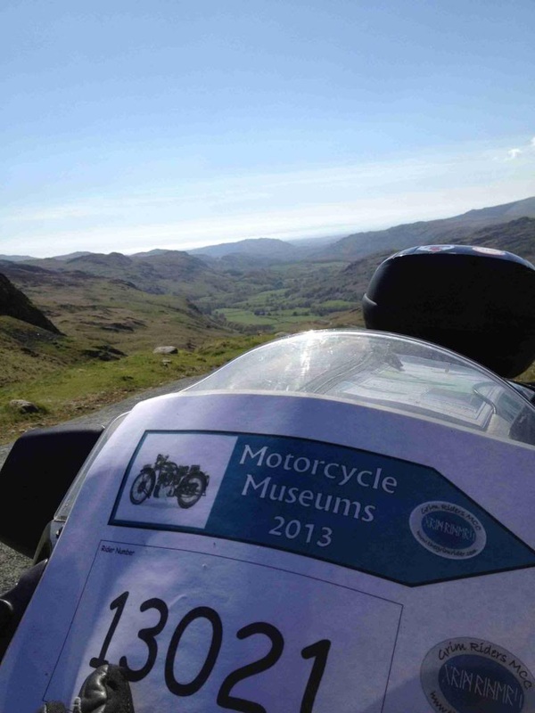
brit butt rally 2013
So it’s rally time again.
After entering it for the first time last year, and having a great time, I decided early on that I would re-enter this year. I certainly had loads of things to improve on and now I at least knew what to expect…kind of.
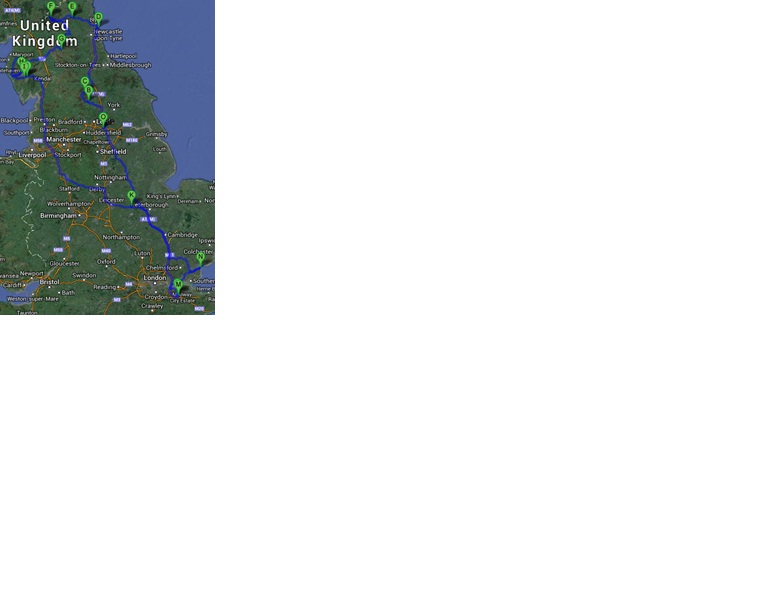
I took my usual saunter down through England, picking up checkpoints for Round Britain Rally etc. and arrived at the hotel in plenty of time for the technical checks and odometer ride. I even knew one or two faces this time, so once I’d checked in and sorted out my
planning paraphernalia, it was down to the bar for a sociable pint.
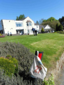
Then it was into the riders meeting and the handing out of the bonus books. This year, the clue to the rally theme was in the title of the rally book, "The Where The Fugarwi Rally". None of the bonus locations would be in cities nor towns, but out in the more remote areas of the country. Oh dear! Last year’ “fun” bonus was a piece of string, which you didn’t actually have to do anything with (despite the various cryptic suggestion going around), just make sure you had it at the end. This year, it was a pink balloon that had to make it all the way round and back to the scoring table. There had been no expense spared on the official balloon inflation measuring device…a cardboard ring, to check the before and after diameters, as well as a stamp to make sure it was the same balloon. The rally team were available to inflate and stamp the balloon up to midnight. Also, in place of a text bonus, you had to take a photograph of a fixed clock (i.e. not your wristwatch or clock on the bike, but one attached to a building) at two times, 10:20 and 23:36. Obviously the 10:20 one could be taken on either the Saturday or Sunday.
The meeting seemed go on for a lot longer than it needed to, due to what were, to me, some obvious questions being asked that had already been answered, or at least were irrelevant. But I suppose everyone has to be sure before they head off, so it’s just one of those
things.
Then it was off to the room for some planning. Last year’s compulsory bonus was one of five glitter balls, but you could visit them
anytime. This year, it was a photograph of a tidal island, but only at low tide! So not only did you have to include it in your route, you had to get there at the right time. Just one more complication to take into account.
But before I did that, I decided to get the balloon inflated so that I could plan uninterrupted. The first two attempts at inflating the balloon, resulted in loud bangs as it burst…maybe the quality of balloon is something I should have taken into account.
One of the main problems with my route last year, at least in my opinion, was that there were a couple of really long stretches with no points. So this year I was determined to create a more economical route. The trouble was that all of the big bonuses were in Scotland, with some long stretches between them…but they did look tempting so I started with those. However, I just couldn’t seem to find a route that let me get the bonuses during the day when needed, find 24 hour fuel during the night, and fit in the tidal bonus as well. Maybe my definition of daylight or tidal times were too restrictive. Maybe, I just need to learn to go with the flow as far as fuel stops are concerned, and not plan the locations into my route. So after about an hour playing with this route, I decided to abandon it and stick with England.
There were a couple of combo bonuses that I looked at, which didn’t involve travelling from one end of the country to another so I built my route around those, and the high level bonuses and finally came up with something that was workable. I tend to leave two hours spare at the end of the route, just in case and this route gave me 90 minutes…that should be plenty!
So it was off to bed at 12:30 for a few hours rest…or so I thought! About 2:30 in the morning I shot awake after a loud bang. I switched on the lights to see the sad sight of bits of balloon lying on the chair where a fully inflated one was when I went to bed. There goes 5000
points and I haven’t even started yet!
After entering it for the first time last year, and having a great time, I decided early on that I would re-enter this year. I certainly had loads of things to improve on and now I at least knew what to expect…kind of.
I took my usual saunter down through England, picking up checkpoints for Round Britain Rally etc. and arrived at the hotel in plenty of time for the technical checks and odometer ride. I even knew one or two faces this time, so once I’d checked in and sorted out my
planning paraphernalia, it was down to the bar for a sociable pint.
Then it was into the riders meeting and the handing out of the bonus books. This year, the clue to the rally theme was in the title of the rally book, "The Where The Fugarwi Rally". None of the bonus locations would be in cities nor towns, but out in the more remote areas of the country. Oh dear! Last year’ “fun” bonus was a piece of string, which you didn’t actually have to do anything with (despite the various cryptic suggestion going around), just make sure you had it at the end. This year, it was a pink balloon that had to make it all the way round and back to the scoring table. There had been no expense spared on the official balloon inflation measuring device…a cardboard ring, to check the before and after diameters, as well as a stamp to make sure it was the same balloon. The rally team were available to inflate and stamp the balloon up to midnight. Also, in place of a text bonus, you had to take a photograph of a fixed clock (i.e. not your wristwatch or clock on the bike, but one attached to a building) at two times, 10:20 and 23:36. Obviously the 10:20 one could be taken on either the Saturday or Sunday.
The meeting seemed go on for a lot longer than it needed to, due to what were, to me, some obvious questions being asked that had already been answered, or at least were irrelevant. But I suppose everyone has to be sure before they head off, so it’s just one of those
things.
Then it was off to the room for some planning. Last year’s compulsory bonus was one of five glitter balls, but you could visit them
anytime. This year, it was a photograph of a tidal island, but only at low tide! So not only did you have to include it in your route, you had to get there at the right time. Just one more complication to take into account.
But before I did that, I decided to get the balloon inflated so that I could plan uninterrupted. The first two attempts at inflating the balloon, resulted in loud bangs as it burst…maybe the quality of balloon is something I should have taken into account.
One of the main problems with my route last year, at least in my opinion, was that there were a couple of really long stretches with no points. So this year I was determined to create a more economical route. The trouble was that all of the big bonuses were in Scotland, with some long stretches between them…but they did look tempting so I started with those. However, I just couldn’t seem to find a route that let me get the bonuses during the day when needed, find 24 hour fuel during the night, and fit in the tidal bonus as well. Maybe my definition of daylight or tidal times were too restrictive. Maybe, I just need to learn to go with the flow as far as fuel stops are concerned, and not plan the locations into my route. So after about an hour playing with this route, I decided to abandon it and stick with England.
There were a couple of combo bonuses that I looked at, which didn’t involve travelling from one end of the country to another so I built my route around those, and the high level bonuses and finally came up with something that was workable. I tend to leave two hours spare at the end of the route, just in case and this route gave me 90 minutes…that should be plenty!
So it was off to bed at 12:30 for a few hours rest…or so I thought! About 2:30 in the morning I shot awake after a loud bang. I switched on the lights to see the sad sight of bits of balloon lying on the chair where a fully inflated one was when I went to bed. There goes 5000
points and I haven’t even started yet!
Next morning saw the unusual site of dozens of bikes with pink balloons attached and stored in variety of ways from top boxes (where did they put what used to be in them?), to cardboard boxes and generous amounts of gaffer tape! At 6:00 on a bright sunny day, we were off. I was planning on getting the compulsory tidal bonus out of the way as early as possible by heading for the nearest, St Mary’s Lighthouse at Whitley Bay. According to the tide times in the bonus book, low tide was at 10:18, and we’d been told that there about an hour’s leeway for the photo, so I had time to get a few points on the way. First stop was Brimham Rocks, along with half a dozen other riders. The gate was shut, so it was a quick hike to the rocks to take the picture. Of course, when I got back to the bike, someone was just opening the gate…sod’s law.
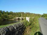
Next up was Leighton Reservoir, and down to four riders now. It’s funny how many different ways there seem to be between checkpoints, with riders peeling off en route, only for you to bump into them again (not literally!) at the next location.
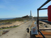
Then it was up to the tidal bonus at St Mary's Lighthouse (it was built on the site of
a monastery where a small sanctuary light would have acted as a guide to passing
ships) and down to three riders, but I was about an hour ahead of schedule so I
might be able to fit a few extras in at the end. Famous last words as it turned
out.
a monastery where a small sanctuary light would have acted as a guide to passing
ships) and down to three riders, but I was about an hour ahead of schedule so I
might be able to fit a few extras in at the end. Famous last words as it turned
out.
At 10:05, on the way out of Whitley Bay, I passed a golf course and thought I’d
be as well to get this out of the way so pulled into the car park and with some
curious looks from the guys on the first tee, I took the relevant picture.
It was then that my trouble started. Somewhere between here and the next checkpoint, my sat nav came up with a message saying that it had stopped charging and did I want to switch to battery power.
After a quick stop to unhook it and reattach, as well as taking the battery out and putting it back in, I carried on. Same message. I decided to get to the next checkpoint, Stengs Cross before taking a better look.
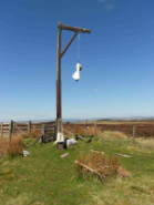
Steng Cross, in the Cheviot Hills, is a stone cross base strung with a wooden head, a gruesome place where justice & punishment meet. After much poking around, I found that the power cable had been severed somehow. So I now had to finish the other 30 hours of the rally on nothing but battery power. Normally, that would have been OK as I would only really need sat nav once I got close to the bonus location. Of course, this would be the year that they are all in the middle of nowhere. So I decided to take a note of the next few turns and switch the unit off until I felt I needed it.
Steng Cross, in the Cheviot Hills, is a stone cross base strung with a wooden head, a gruesome place where justice & punishment meet. After much poking around, I found that the power cable had been severed somehow. So I now had to finish the other 30 hours of the rally on nothing but battery power. Normally, that would have been OK as I would only really need sat nav once I got close to the bonus location. Of course, this would be the year that they are all in the middle of nowhere. So I decided to take a note of the next few turns and switch the unit off until I felt I needed it.
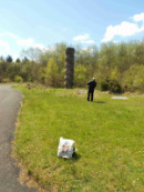
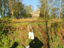
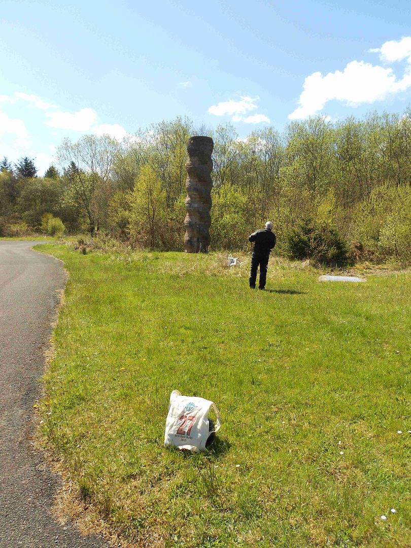
I found the next location without any problems, although we I got there, there was one other rider looking at a closed gate. The location wasn’t in sight, so should we walk along the road and see if it came into sight? On closer inspection, there were tyre tracks around the gate, so we decided to ride around it, and of course the location was only 100 yards round the corner…Kielder Column. This sculpture is a stock of pink sandstone blocks arranged in courses around a core. Built in 1990, and re-erected here in 1999.
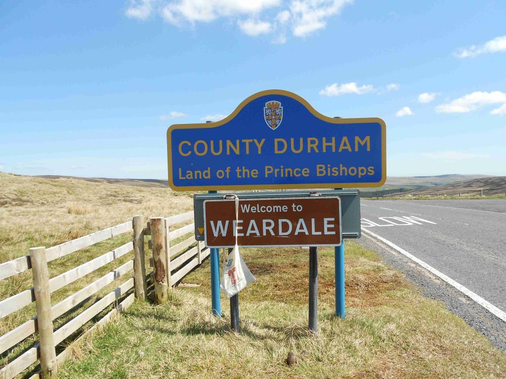
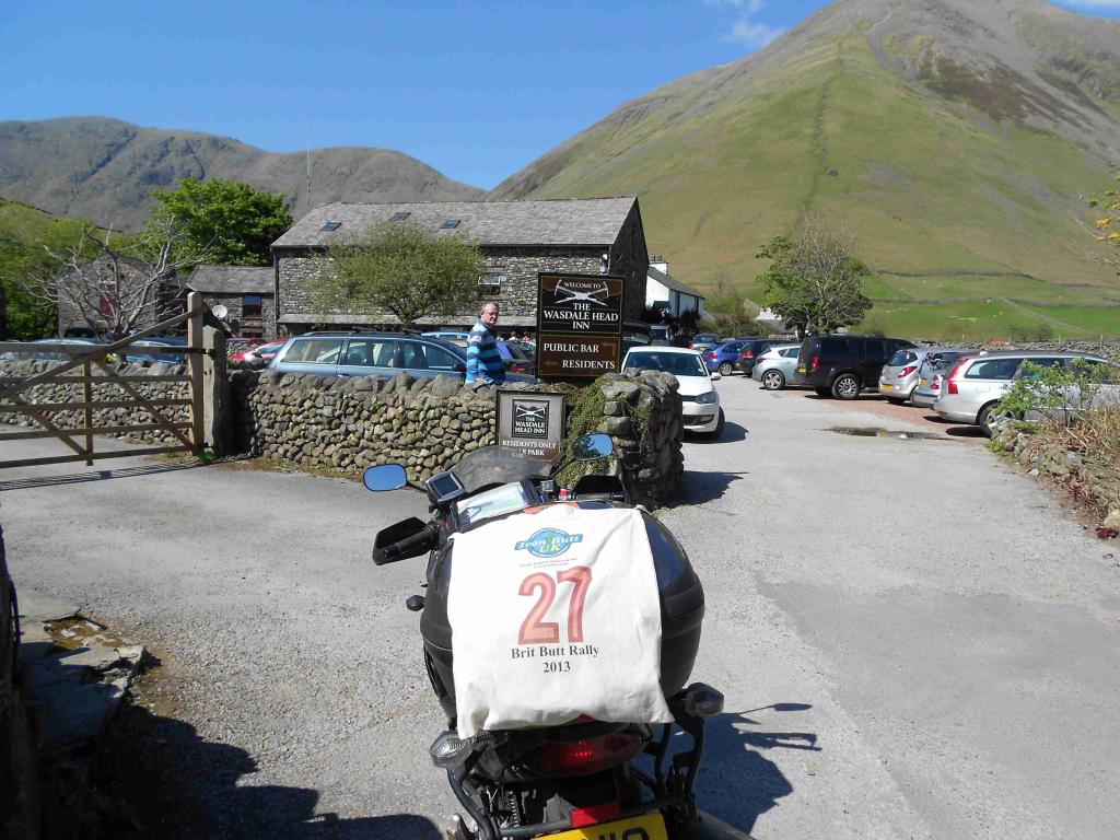
So switching the sat nav on and off, I managed to find Killhope Cross. This mountain pass in the Pennines, divides Weardale to the east and Cumbria to the west. The journey to the next location was torture. Although there was only one road, so directions weren’t a problem, there was no room to pass and it was crowded with cars and campervans, most of whom seemed intent on going as slow as possible and not letting anyone pass at the passing points. An eternity later, I reached the Wasdale Head Inn knowing I had to retrace my steps for a while to get to the next checkpoint. The route would take me over the Hardknott Pass, so I took the opportunity to capture a Grim Rider Mountain Pass photo. You really should try this pass, it's not for the faint hearted.
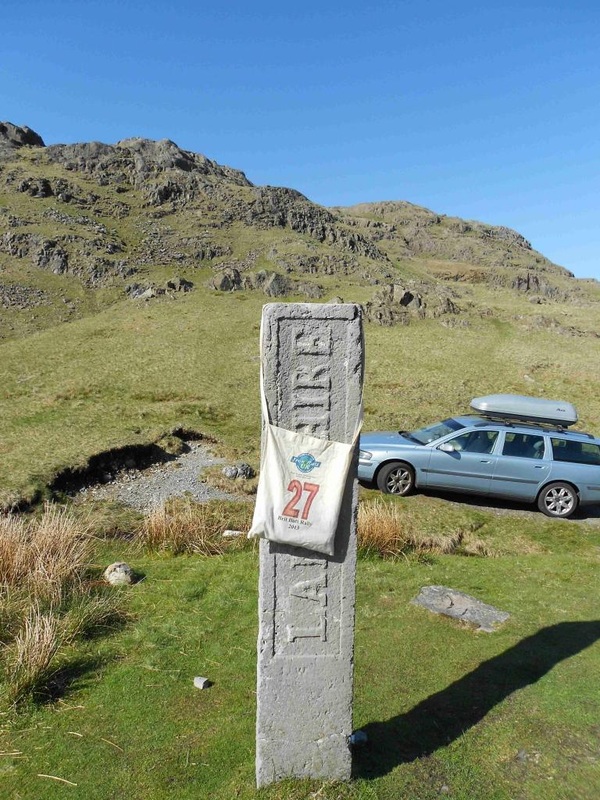
Three Shire Stone is a boundary stone that marks where the historic English counties of Lancashire, Cumberland and Westmorland meet
I met Niki Haines and John Young, who was having a few problems with his clutch cable. A rest and a wee chat later we went our separate ways. I had planned to pick up the 150 point Cross Keys Temperance Inn, but John and Niki reckoned that it would take too long to get to for 100 points, and my sat nav issues meant that I was starting to fall behind schedule, so I decided to give it a miss (in the end it wouldn’t have made any difference on my overall position).
From here it was on to Wing Miz Maze. Measuring 40ft in diameter this rare legacy from feudal times
probably evokes a prehistoric pagan tradition. This was the start of problems with turning in the dark…not so easy to find without sat nav warnings.
probably evokes a prehistoric pagan tradition. This was the start of problems with turning in the dark…not so easy to find without sat nav warnings.
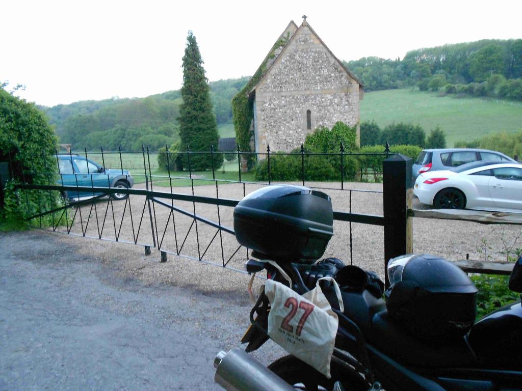
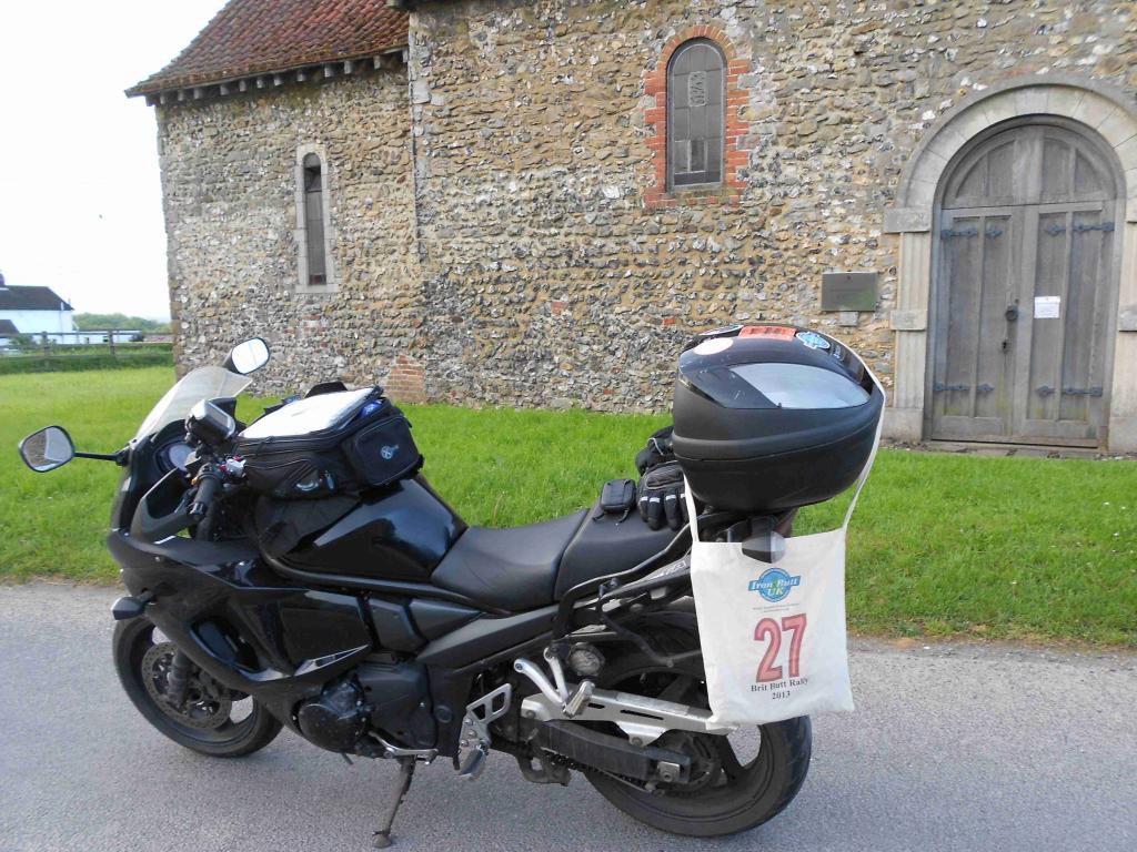
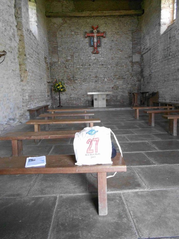
I had been due to head for the first of my combo bonuses, Dode Church, in Kent. Built in 1100 as a place of worship until the Black
death wiped out the entire area. This was planned to be my longest stretch without any points, but meant that I was getting there in the early hours of the morning. Considering the hassle I’d had at the last location, I decided to take my rest bonus earlier than planned
and continue on at first light. In the end this turned out to be a wise choice, as the roads to the church were small tracks just about wide enough to navigate down. Certainly not the sort I’d like to try in the dark! The next two stops were the other parts of the bonus, but between here and the next one, the sat nav finally gave up the ghost, but I was close enough to scramble my way to St Benedicts Church . St Benedict’s is a 900 year old Pilgrim’s Church on the North Downs
I desperately need to get some fuel by now. Debbie Devine pulled up right behind me here and, after hearing of her own problems with water and hedges, showed the true spirit of the rally and gave me a loan of her spare sat nav. It ran out quite quickly but still managed to get me to a petrol station, so thanks Debs! I wasn’t going to give up on the last part of the combo bonus now, so a bit of searching on the website for St Peter on The Wall, and I had turn by turn directions. This is the 19th oldest building in England and is still in regular use. The building dates from the 7th century. Off I went and pulled into the car park but couldn’t see the church. There was a sign saying that the church was along a path, so off I set. A 10 mile hike later (or at least it seemed like it) and the last part of the combo was done
My original plan had been to go from here, round Norfolk for another 4 or 5 locations, then back to the finish, but I’d just about had it with wrong turns up small country lanes, and decided to just head for the finish to make sure I didn’t lose points by being late. On the way, I had stopped for breakfast, a luxury I could now afford without the pressure of time, and realised that it was 10:00. I decided to get a backup picture of a clock, just in case ( a wise choice as it turned out)
I was back at the rally finish in plenty of time, so a relaxing shower and a few leisurely pints whilst watching other riders come in, were the order of the day. But first, I had the scoring table to get past. All was well until we looked at the first clock photo…the clock showed 8:20! I hadn’t even seen the time was wrong, obviously focussing on the 20 past element…just as well I had the other one! I didn’t lose any other points at the table, so time for that shower!
In the final results I finished up 28th out of 43, which was 3 places lower than last year, but slightly further up the group of finishers so
I was happy enough. Yet again, I thoroughly enjoyed the rally and thanks to those who put it together and ran it over the weekend.
More lessons to learn for next year;
Next time, I might aim for Top Twenty!
In the final results I finished up 28th out of 43, which was 3 places lower than last year, but slightly further up the group of finishers so
I was happy enough. Yet again, I thoroughly enjoyed the rally and thanks to those who put it together and ran it over the weekend.
More lessons to learn for next year;
- Have a backup sat nav (or at least battery).
- Always check your photo carefully, especially if it needs to show something specifically.
- Mark up locations on paper as well, so that you can at least get close to the bonus location before needing to rely on sat nav…just in case.
- Take a few more risks in planning…plan a route than can be cut short, rather than one than can be added to. It makes better use of the available time
Next time, I might aim for Top Twenty!
